SAVE LAND WEST OF IFIELD CAMPAIGN

Article published 1st February 2024
With so much of Crawley being densely populated, it’s easy to forget that there are parts of the Borough that have retained their historic charm.
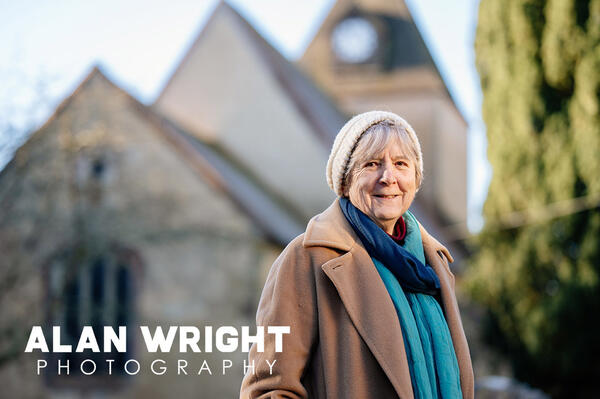
Ifield and Worth were recorded in the Domesday Book of 1086, and although the former is now dominated by housing east of Rusper Road, the old village has survived on the other side of the road. Here, a close-knit community centres around the Plough Inn, Barn Theatre and the Grade I listed St Margaret’s Church, parts of which have stood since the 13th century.
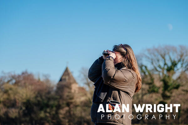
Ifield Village is a designated conservation area, making it popular with ramblers and dog walkers. The church is home to a yew tree thought some 700 years old, while in the meadows children can leap between ancient ant hills. Beyond the meadow you’ll find Ifield Brook, linking Ifield Mill Pond (which rail commuters to London will be familiar with) to the south and the River Mole to the north. Turning to face Ifield Village from just beyond the brook, you’ll see the view in the photo here, with the spire of St Margaret’s rising above the tree line. You’re no longer stood in the Borough of Crawley, but on the north-eastern tip of the Horsham District.
This is significant, as this area – known as West of Ifield in planning documents - has been earmarked by Horsham District Council for development. It would initially accommodate 3,000 new homes, making it the largest new site for ‘strategic scale’ development in the latest version of the HDC’s Local Plan. However, this number could eventually rise to 10,000 homes, significantly bridging the gap between the towns of Horsham and Crawley.
In some parts of the Horsham District, there was a sense of relief when the latest version of the Local Plan was released. Proposals to develop at Buck Barn and Adversane are no longer included and these sites have been shelved, for now. Yet in Crawley, there is a feeling that Horsham is unloading a huge part of its housing allocation on its doorstep.
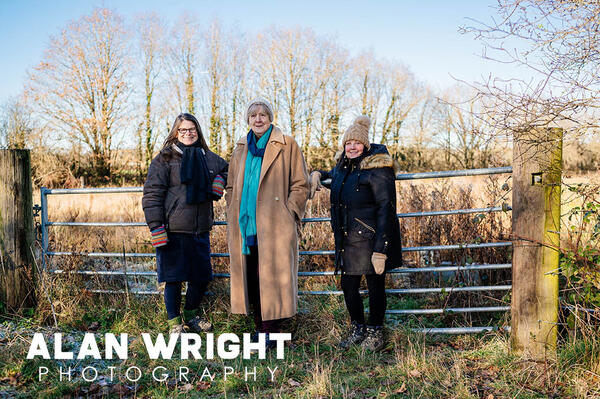
Cathy Durrant of the Save West of Ifield group, said: ‘This is the last remaining place where people living in Crawley can walk to without having to cross a major road and enjoy the solitude of the countryside. We find it frustrating that Horsham District Council has gone to great lengths to protect its own rural escape at Chesworth Farm, yet are prepared to completely destroy ours. It just feels wrong.’
LOCAL PLAN
Before we look in-depth at the site, here is the current state of play. Horsham District Council has published the Horsham District Local Plan 2023 – 2040 (Regulation 19), a document which replaces the Horsham District Local Plan 2019 – 2036 (Regulation 18). The aim of the Local Plan is to ‘deliver the social, economic and environmental needs of the Horsham District from 2023 – 2040’, while also considering a longer-term context of up to 30 years for strategic scale development. Regulation 19 is now subject to a consultation which runs until 1 March.
The most contentious, aspects of the Local Plan are the sites outlined for housing. Many locations have been considered (readers may recall reading about threats to Chesworth Farm, Rookwood and Buck Barn in the local press) and gradually, the Council’s planning department has whittled them down, leaving just three ‘strategic sites’ for significant development. These are land west of Ifield (3,000 dwellings), land north west of Southwater (1,000) and land east of Billingshurst (650).
The Plan identifies 13,212 homes for development in total, although some will be built at other ‘strategic locations identified in previous versions of the Local Plan, where building is already underway, including Kilnwood Vale, land west of Southwater and land north of Horsham (now known as Mowbray). In addition, smaller-scale sites have been identified in Neighbourhood Plans. All in all, an average of 777 houses will be built in the District over the next 15 years.
This figure is not dictated by Horsham District Council. It is set by the National Planning Policy Framework (NPPF) and directives feed down to local authorities across the country. Local Councils must do their best to balance the government’s demands with those of their communities and there is a feeling that the Horsham District and the wider South East region has been overly burdened with new housing, threatening vast tracts of greenfield land.
Fenella Maitland-Smith, Chair of Save West of Ifield, said: ‘We have published information about how the government calculates its housing targets and it is evident that the Horsham District suffers, as urban areas such as Crawley to the north and coastal towns to the south cannot take much more housing.’
‘We have set up stands in Horsham town, as well as the CPRE Sussex Countryside Day at Knepp last September, and were delighted by the reaction we received from Horsham residents. Not one person expressed happiness that all these new houses would be built in our back yard rather than theirs. Instead, they feel as we do that the level of development is unsustainable.’

CLOSING THE GAP
If there is a feeling in Crawley that local authorities around them are building on its boundaries, then it isn’t without foundation. Previously, Mid Sussex District Council approved the Woodgate development at Pease Pottage, while Tandridge District Council identified land in Copthorne for housing on Crawley’s northern border.
If HDC’s Local Plan proceeds as expected, land west of Ifield would initially accommodate about 3,000 homes, 1,600 of which would be delivered during the period of the Local Plan, along with facilities including a neighbourhood centre and possibly a secondary school. Travel improvements could include the first phase of a link road connecting the A264 at Faygate to the A23 north of Crawley.
However, the development proposed in Regulation 19 accounts for only a fraction of the land to the west of Ifield. The whole site forms a broad arc around fields on the western edge of Crawley, stretching all the way down to Faygate. In future, there is potential for up to 10,000 homes, delivered as three neighbourhoods. This would significantly close the strategic gap between Horsham and Crawley, especially with Mowbray growing out towards it.
Because of its location in the heart of the Gatwick Diamond, the land may be perceived as the best place for new homes. It has employment prospects at the airport, while road, bus and rail links are established. The west of Ifield site has the added convenience of being ‘available and deliverable’, as the land is controlled by Homes England, the government’s own housing and regeneration agency. This includes land occupied by Ifield Golf Club, which is within the area set to be developed. However, campaigners say that Gatwick cannot necessarily be depended upon to provide jobs.
Fenella Maitland-Smith said: ‘It is easy to say there are employment opportunities because of Manor Royal and Gatwick Airport, but many jobs are being lost to automation and the jobs that are available are often low-paid. There is also a case for the Local Plan to be delayed until a decision is made on the second runway. If the airport is granted permission to expand, then would it not be logical to have a regional approach to development and infrastructure? Gatwick has made claims about the economic benefits of any expansion and if these figures are accurate, then perhaps we should align Local Plans with any decision on the airport’s future.’
RICH DIVERSITY
The Save West of Ifield campaign also point to the natural beauty of the area, which it believes is worth protecting. HDC’s Local Plan makes note of the ‘rural character’ of the area, which includes ancient woodland, a section of the River Mole, Ifield Brook Meadows and St Margaret’s Church in the Ifield Village Conservation Area. Any development ‘must respect the rural and natural environment and local heritage’ and ‘be brought forward in a sensitive way which generates net biodiversity gain’. It must also mitigate any adverse impacts on protected species, such as bats. Recent surveys have revealed the site supports a breeding population of the rare Bechstein’s bat.
Fenella said: ‘The area has rich diversity in terms of its wildlife, with ancient woodlands and hedgerows supporting a variety of birds. Connected habitats are dotted around the parish of Rusper and we are concerned that we will lose natural corridors with any development. While Ifield Brook Meadows are not part of the proposed development, it would be sandwiched between the new houses and Ifield West village. It will be criss-crossed by lit bridleways and footpaths to provide access into Crawley for residents of any new development, which in turn will impact the character of the village and the conservation area.’
‘Gatwick Airport Ltd has done fantastic work in studying the biodiversity in and around the area too, employing an ecologist. They have collaborated with Surrey and Sussex Wildlife Trust as part of the Gatwick Greenspace Partnership and recorded many species including nightingales, birds of prey and Bechstein’s bat. Previously, roosting colonies have led to areas being designated as special areas of conservation, but you need the landowner’s position permission to do that and that’s Homes England.’
Any new development must also provide a comprehensive ‘Ecology and Green Infrastructure Strategy’, which includes a ‘Biodiversity Net Gain Plan’ to demonstrate how a minimum 12% net biodiversity gain will be achieved. However, campaigners say that large parts of the site, including the golf course, have not been properly surveyed.

WATER NEUTRALITY
The West of Ifield development would signal the end of Ifield Golf Course. However, National Planning Policy Framework states that any sporting facility that is going to be lost needs to be replaced unless it is surplus to requirements. It is unclear yet whether this is the case.
Another concern is water neutrality. In September 2021, Natural England published a statement that showed that the abstraction of water to supply homes and businesses is having a negative impact on protected wildlife in the Arun Valley. They advised that any development in the North West Sussex water supply area mustn’t add to this negative effect.
Much of the South East, including Horsham District, has also been designated as an ‘area of serious water stress’ by the Environment Agency. All of which has had an impact on the Local Plan. Water restrictions and legislation has contributed to a slowing down of new houses being built and it’s an issue that will need to be resolved in the west of Ifield too.
Jenny Frost, who has extensive knowledge of the heritage of Ifield Village and Rusper, said: ‘If we’re to build 3,000 houses West of Ifield, housing approximately 7,500 people, their water will have to be found somewhere. That’s a lot of water, especially at a time when Southern Water are handing out devices for people to time their showers! The other issue is what to do with all the waste water, which presumably would feed into the River Mole. Large sections of the Mole have been declared as being polluted and unhealthy, so we have many environmental concerns too. We’ll continue to fight for all these reasons.’
WORDS: Ben Morris / PHOTOS: Alan Wright
Further information: The proposed submission and the feedback form can be viewed on the Council’s website at https://www.horsham.gov.uk/planning/local-plan/local-plan-regulation-19


